Newport Street is shut for an anticipated 549 days, and the M5 closes overnight between junctions 7 and 9 on three nights. Every live closure, dated and sourced.
The biggest of the Worcester roadworks right now is Newport Street, shut since 19 August 2026 between All Saints Road and North Parade under an order made for an anticipated 549 days. Prestwood Estates Limited is carrying out development works, the 1970 one-way order on the street is suspended for the duration so residents and businesses can get in and out, and there is no emergency services exemption: the signed diversion via All Saints Road, Bridge Street and North Parade has to be followed. This is the longest closure in the city by a wide margin.
Two other things are worth knowing this week. B4639 Cotswold Way in Warndon shuts for two nights from 20 August, 20:00 to 06:00, for resurfacing. And National Highways has the M5 shut between junctions 7 and 9 on three nights, Friday 21, Monday 24 and Tuesday 25 August, 21:00 to 06:00. Junction 7 is Worcester South.
Everything dated on this page comes from Worcestershire County Council’s statutory closure notices published on 6, 13, 14, 19 and 20 August 2026, from National Highways’ seven-day report for 19 to 25 August, and from the council’s own emergency closure register read on 20 August. Roadworks change weekly, so the section after the tables is how to check for yourself, and everything after that is the part that does not change.
What is shut in Worcester now
Orders the council has already made, so these are decisions rather than proposals. Durations are the council’s own “anticipated” figures.
| Road | When | Why |
|---|---|---|
| Newport Street, All Saints Road to North Parade | From 19 August, anticipated 549 days, 24 hours | Development works by Prestwood Estates |
| B4639 Cotswold Way, Nortleach Close to Badgeworth Drive | 2 nights, 20:00 to 06:00, from 20 August | Resurfacing |
| Linden Road, Tunnel Hill to Sycamore Road | 15 days from 19 August, within a window to 9 September | Footway reconstruction |
| Greenacres Road, Rea Way to Penshill Crescent | 11 days from 17 August | Footway reconstruction |
| Cornmeadow Lane, Ombersley Road to St Annes Road | 15 days from 11 August | Footway reconstruction |
| Green Lane, Lower Broadheath | 28 days from 17 August | Severn Trent water main |
| Arundel Drive, Sebright Avenue to Battenhall Avenue | 15 days, within a window of 10 to 28 August | Footway reconstruction |
| Mortlake Avenue, and Silverdale and Redfern Avenues | 2 days each, within a window of 17 to 28 August | Resurfacing |
| Hillery Road and Prestwich Avenue | 2 days each, within a window that closes on 21 August | Resurfacing |
| A449 Worcester Northern Link, northbound, Warndon Interchange to the Blackpole Road exit | 2 nights, 20:00 to 06:00, within a window that closes on 20 August | Resurfacing |
Two things worth reading off that list. Several of these orders give the council a window rather than fixed dates, and the council does not publish which nights inside the window it will actually use. That matters for two of them right now. The A449 Northern Link window runs out on 20 August, so tonight is the last night the council can use it. The Hillery Road and Prestwich Avenue window closes on 21 August. If either job has not happened yet, it happens in the next day or two or not at all under this order. The estate programme in Warndon and Tunnel Hill is still running, so if you live on either you should expect your own street’s turn before the end of the month.
The classified roads come off lightly. Every closure on an A or B road in the city this fortnight is measured in nights: two on the B4639 Cotswold Way, and the tail end of the A449 Northern Link window. The jobs measured in weeks are all on unclassified streets, where the council can take a fortnight without displacing through traffic. The exception is Newport Street, and that is a developer’s closure rather than a council one.
Three notices running have now carried no Worcester city orders at all. The council published on 14, 19 and 20 August, and every closure in them is somewhere else in the county:
- 14 August: Uckinghall, Pendock, Dunley, Upton upon Severn, Malvern and Hanley Castle.
- 19 August: Barnt Green, Bromsgrove, Frankley, Hunnington, Hartlebury and a footpath at Chawson Pleck in Droitwich Spa.
- 20 August: Eldersfield, Coles Lane, Back Lane at Bredon, Bushley Green, and a bridleway at Beckford whose closure has been extended to 24 November.
So nothing new has been ordered in the city for a fortnight, and the table above is the current picture. The next weekly notice is due on 27 August.
Proposed for the end of August and September
These are proposed orders, not yet made, so treat the dates as intentions. The A4440 one is the one to watch, because it is the ring route.
- A4440 Parsonage Way, Trotshill Way and Grange Way, Warndon, from The Pears roundabout through Plantation Drive and Dugdale Drive roundabouts to the Market roundabout: 3 nights, 20:00 to 06:00, between 7 and 18 September, for patching ahead of surface dressing. Diversion via Berkeley Way, Woodgreen Drive and Nunnery Way.
- B4206 Henwick Road, Oldbury Road to Hardwick Close: 2 days from 29 August, Severn Trent.
- Catherine Road, Swinton Lane to Worboys Road: 3 days from 31 August, BT.
- Vincent Road, Wylds Lane to Cecil Road: 28 days round the clock from 1 September, for a Cadent gas main.
- Diglis Lane, Diglis Rock Road to Greenway Drive: 15 days round the clock from 1 September, footway reconstruction.
- Canterbury Road, Durham Road to Carlisle Road: 3 days from 1 September, Severn Trent.
- St Oswalds Road, Chestnut Walk to Upper Tything: 19 days round the clock from 7 September, for an electricity cable replacement by S&R Construction for Mua Electricity. That is a separate scheme from the Severn Trent job that ran there this month.
- Fort Royal Hill, London Road to Upper Park Street: 4 days from 7 September, Cadent gas main.
- Northfield Street and East Street: 4 days from 7 September, National Grid cable replacement.
- Park Avenue, Ivy Street to Kepax Gardens: 4 days from 7 September, Severn Trent.
- Manor Road (7 September, 3 days) and Hanbury Avenue (10 September, 2 days), both for drainage and flood alleviation.
- Newland Crescent, Bransford Road to Old Bransford Road: 3 days from 8 September, Severn Trent.
The council is also consulting on a no waiting at any time restriction on the south side of Laugherne Road, west of Comer Road. Objections go to roadtrafficregs@worcestershire.gov.uk, or County Hall, Spetchley Road, Worcester WR5 2NP, by 10 September 2026.
The motorways: M5 work at Worcester South, and the M50 eastbound
National Highways’ report now covers 19 to 25 August 2026 and was last updated at 15:30 on 19 August. Reading it junction by junction around the city:
- Junction 7, Worcester South. The report carries an M5 northbound junction 8 exit slip closure on the nights of Friday 21, Monday 24 and Tuesday 25 August, 21:00 to 06:00, and National Highways describes the scheme itself as “M5 both directions Jct 7 to Jct 9. Carriageway closure for maintenance works. Diversion via National Highways network.” That is a night more than the report carried a week ago. If you use junction 7 after 21:00 on any of those three nights, expect to be diverted.
- Junction 6, Worcester North. Nothing all week, for the second week running.
- Junction 5, Droitwich. The northbound entry slip is closed on the nights of Sunday 23 and Tuesday 25 August, 21:00 to 06:00, for maintenance.
- Junctions 4 to 3, north of Bromsgrove. The M5 is closed northbound between them on the nights of Monday 24 and Tuesday 25 August, 22:00 to 06:00. That is the Birmingham run, so it is worth knowing if you drive back late.
- The M50 is closed eastbound from junction 4 to junction 2 on the nights of Thursday 20 and Friday 21 August, 21:00 to 06:00. Then the junction 1 slip roads close: westbound entry and exit on the night of Monday 24 August, and eastbound entry and exit on the night of Tuesday 25 August, both 21:00 to 06:00. That matters if you are heading for Ledbury, Ross-on-Wye or South Wales after dark.
- The M42 links at junction 4a. The M42 southbound link to the M5 southbound, and the M5 northbound link to the M42 northbound, both close on the night of Thursday 20 August. The M5 southbound to M42 northbound link closes on the night of Saturday 22 August. All 21:00 to 06:00.
- The A46 in Worcestershire. The stretch between Beckford and Ashton under Hill closes in both directions on the nights of Monday 24 and Tuesday 25 August, 21:00 to 06:00, for maintenance. That is the Evesham and Cheltenham road, and the diversion is via the National Highways and local authority network.
The council’s own live register of emergency closures, the ones caused by voids, landslips and collapsing buildings rather than planned work, listed four across the whole county on 20 August and none of them in Worcester: Sutton Road in Kidderminster (a void in the carriageway, closed since 15 July), the Kingsway in Stourport on Severn (since 25 June), the B4204 at Rochford (since 6 February) and The Strand in Bromsgrove (a collapsing building, since 25 January).
How to check what is shut today
- one.network for Worcestershire is the map Worcestershire County Council itself points residents to. It runs on Department for Transport permit data, so it shows every permitted set of works, who is doing it and the dates. You can register for email alerts on a zone you choose.
- National Highways road closure report covers full closures on the M5, M50, M42 and A46, seven days ahead. Filter by road number, or download the spreadsheet the page links, which has a sheet per day. This is the one to check before a night drive.
- The council’s emergency road closure list is the one most people miss. It is a plain page of the unplanned closures currently in force across the county, with the date and time each one went on, and it is where a sudden void or landslip shows up before anything else.
- The statutory notices are the primary record, and they are the source of the dates above. The council places them weekly in the Worcester News and they are republished on the Public Notice Portal. Search a Worcester postcode and read the traffic and roads notices: each one gives the exact extent, the reason, the signed diversion and whether the order has been made or is only proposed.
- Report a pothole to Worcestershire County Council if the problem is the road surface. The Highways and Transport Control Centre is on 01905 845676, Monday to Friday, 9am to 5pm.
One caveat the council flags: the county’s own map does not show temporary traffic lights. Those are the responsibility of whoever is doing the work, whether that is Severn Trent Water, Cadent Gas or the council’s own contractor, and the number to ring is on the board at the site.
Who is responsible for which road
This catches people out constantly, so it is worth stating plainly.
| Organisation | Responsible for |
|---|---|
| National Highways | The M5, M50, M42 and A46 |
| Worcestershire County Council | Every other road, pavement, street light and bridge in the city |
| Worcester City Council | Car parks, and planning decisions on new development |
So the council with “Worcester” in its name does not fix the roads. The county council does, across a network of 4,101 km (2,548 miles) of highway, including 575 km of A roads, 55,068 street lighting columns and 1,462 structures such as bridges and retaining walls. Its maintenance contractor on the ground is Ringway Worcestershire.
That split survives until 1 April 2028, when Worcester City Council merges with Malvern Hills and Wychavon into a single South Worcestershire unitary authority, which will take on the county council’s highway role inside the new boundary.
What the county actually repairs
Worcestershire filled an estimated 16,022 potholes in 2024/25, up from 15,557 the year before and the highest of the last five years. Its published plan for 2025/26 is to fix around 30,000 defects, of which roughly 16,000 are potholes, surface dress 200 km of carriageway, resurface 80 km and reconstruct 70 km of footway.
Where it can, the council cuts out and patches rather than filling: it says over 75% of identified potholes are repaired to that standard rather than being given a temporary fix. Capital spending on highway maintenance was projected at £52.6m for 2025/26 against a Department for Transport allocation of £29.6m, with the balance funded locally.
The routes that carry Worcester
Worcester is unusual among cities its size in having two motorway junctions of its own. Junction 6 is signed Worcester North and feeds the A449 and A4538; junction 7 is Worcester South and feeds the A44 and the A4440 Southern Link Road. Between them they mean most of the city is within about ten minutes of the M5, which is a large part of why the Shrub Hill and Worcestershire Parkway area has been a focus for development.
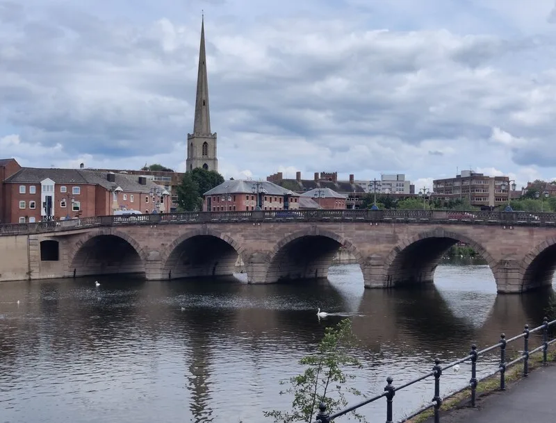
The constraint is the river. The Severn runs north to south through the middle of the city, and everything crossing between the centre and St John’s or the racecourse side has to use one of a small number of bridges. Worcester Bridge in the centre carries the A44, and the A4440 crosses at Carrington Bridge to the south. When one is disrupted, the other absorbs it, which is why a set of works on either shows up as delay across the whole city.
Travelling without the car
- Under-16s travel free on the bus across Worcestershire until 31 August 2026, funded by the Department for Transport as part of the Great British Summer Savings programme. It covers Diamond Bus, First Bus, Kevs Cars and Coaches, LMS Travel, Landflight, Stagecoach and Worcestershire on Demand, though the council warns that not every local operator is in the scheme, so check before you travel. It has not said what happens on 1 September.
- Worcestershire on Demand is the county’s app-booked minibus service, and it is included in the free travel offer.
- The train is the fastest way to Birmingham, at 42 to 45 minutes from Foregate Street, and to London at about two hours. Foregate Street has no car park at all, so driving to the train means Shrub Hill (93 spaces) or Worcestershire Parkway (483). Our Worcester trains to London page has the times and the season ticket prices.
- No engineering work is planned on the Worcester lines before October. Great Western Railway’s planned engineering list shows nothing affecting the city until Sunday 4 October, when maintenance at Shrub Hill puts buses between Worcestershire Parkway and Great Malvern. Cheltenham area track renewal then hits the Gloucester line on the weekends of 3 to 4, 10 to 11 and 17 to 18 October, with buses between Gloucester and Worcester Foregate Street, and the Foregate Street to Hereford renewals run 26 to 30 October, with buses from Shrub Hill to Great Malvern and Hereford.
There is no permanent park and ride in Worcester. The service the county council publicises runs from County Hall for the Victorian Christmas Fayre weekend, operated commercially by First Worcester, rather than year-round.
The A449 at Malvern, still shut with no reopening date
This is outside the city, but it is the road Worcester drivers take for the Malverns and the M50, and it has now been closed for the best part of a year.
The A449 Wells Road is closed between British Camp car park and Little Malvern after two landslips. The first affected a 30 metre stretch with long-term subsidence; a second went several hundred metres away during the repair, which is why the road did not reopen when the first job finished in April 2026. The council’s last published update, in July, says detailed ground investigation for the second slip was under way on site and expected to finish by the end of that month, and that “it remains too early to give any possible re-opening dates for the road”. No newer update had been posted by 20 August, so the road has now been shut for the best part of a year with nothing published since July. The signed diversion runs via Welland, Rye Cross and Bradlow, supported by variable message signs.
Frequently asked questions
What roads are closed in Worcester this week?
Newport Street, between All Saints Road and North Parade, has been shut since 19 August 2026 for an anticipated 549 days. The B4639 Cotswold Way shuts overnight for two nights from 20 August. Linden Road, Greenacres Road and Cornmeadow Lane are shut for footway reconstruction, Green Lane at Lower Broadheath for a Severn Trent water main, and estate roads in Warndon and Tunnel Hill are being resurfaced through to the end of the month. The council’s weekly notices of 14, 19 and 20 August added no new city closures at all.
Where can I see live roadworks in Worcester?
On one.network’s Worcestershire map, which the county council uses as its own public map, and on the council’s emergency road closure list for unplanned closures. For motorway closures, use the National Highways closure report.
Who do I report a pothole to in Worcester?
Worcestershire County Council, not the city council. Use its report a pothole form or ring the Highways and Transport Control Centre on 01905 845676.
Is the M5 closed near Worcester this week?
Yes, on three nights. National Highways’ report for 19 to 25 August 2026 lists an M5 northbound junction 8 exit slip closure on the nights of Friday 21, Monday 24 and Tuesday 25 August, 21:00 to 06:00, and describes the scheme as a both-directions carriageway closure between junctions 7 and 9 for maintenance. Junction 7 is Worcester South. Junction 6, Worcester North, is clear all week. The junction 5 northbound entry slip closes overnight on 23 and 25 August, and the M5 is shut northbound between junctions 4 and 3 overnight on 24 and 25 August. The M50 is shut eastbound from junction 4 to junction 2 overnight on 20 and 21 August, and its junction 1 slip roads close westbound on 24 August and eastbound on 25 August.
How long is Newport Street closed for?
The order was made for an anticipated 549 days from 19 August 2026, round the clock, for development works by Prestwood Estates Limited. That takes it to February 2028 if it runs its full anticipated length. The one-way order on Newport Street is suspended for the duration so residents and businesses can get in and out. Emergency services have no exemption, so the diversion via All Saints Road, Bridge Street and North Parade must be followed.
Which M5 junction is Worcester?
Both junction 6 and junction 7. Junction 6 is signed Worcester North, for the A449 and A4538; junction 7 is Worcester South, for the A44 and the A4440 Southern Link Road.
Does Worcester have a park and ride?
Not permanently. The county council’s publicised park and ride runs from County Hall for the Victorian Christmas Fayre weekend and is operated commercially by First Worcester.
How many potholes does Worcestershire fill?
An estimated 16,022 in 2024/25, and the council’s plan for 2025/26 is roughly 16,000 potholes within about 30,000 defects in total.
Sources
- Worcestershire County Council public notices under the Road Traffic Regulation Act 1984, published in the Worcester News on 6 August 2026, 13 August 2026, 14 August 2026, 19 August 2026 and 20 August 2026, for every dated closure, extent, reason, diversion and whether the order is made or proposed.
- National Highways seven-day closure report, week of 19 to 25 August 2026, last updated 15:30 on 19 August, for the M5, M50, M42 and A46 closures.
- Worcestershire County Council, current emergency road closures, read on 20 August 2026.
- Worcestershire County Council, roadworks and live updates for the live map and temporary traffic light responsibility, and A449 Wells Road, Malvern for the landslip closure and its diversion.
- Great Western Railway, planned engineering work for the October dates and the absence of anything sooner.
- Worcestershire County Council, Local Highway Maintenance Transparency Report for network length, pothole numbers, spending and the 2025/26 programme.
- Worcestershire County Council, local bus information for the August 2026 free travel offer for under-16s.
- Worcestershire County Council, Worcester Woods Country Park for the M5 junction and A-road signing used in the diagram.
Roadworks information was checked on 20 August 2026 and changes constantly. Two caveats on that date. The one.network map the council points residents to needs an account and cannot be read from a script, so the closures listed here come from the council’s own statutory notices and its emergency closure register rather than from the map, and any works permitted since the notice of 20 August will not be in the tables above; the next weekly notice is due on 27 August. And the council’s A449 Wells Road page had not been updated since July, so the position on the second landslip could not be confirmed any later than that. Always check the live map before you travel.
Have your say
We read every message. To comment on this story, email the newsdesk and we may publish a selection of responses: hello@worcestertimes.co.uk.